Service · Mapping & 3D models

Current aerial maps and 3D models for planning

Up-to-date overhead maps (orthomosaics) and 3D models of sites and buildings, as visual references for planning, design context and marketing. Not a land survey.

  • Every job is planned around the FAA’s Part 107 rules for commercial drone operations.
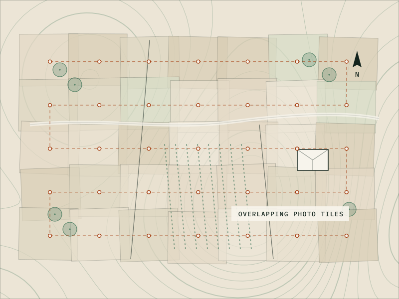
Illustration of an aerial map stitched from overlapping photo tiles, drawn over a contour map.
02 Overview

Mapping & 3D models

Online satellite imagery is often out of date and too blurry for planning. An aerial map stitched together from many overlapping drone photos gives you a current, detailed overhead view of your site. The same photos can produce a 3D model, delivered as still views and a fly-around video.

These maps and models are visual references for planning, design context, presentations and marketing. They aren’t land surveys or measurement tools, and before we quote a mapping job we check what your state’s surveying rules allow.
Ideal for

  • Developers and landowners planning a site
  • Architects, landscape designers and other designers who need current site context
  • Property managers who want a current site overview for presentations and planning discussions
  • Marketers who want a 3D view of a property
03 Deliverables

What you get

Exact formats and quantities are listed in your quote.

Map
Orthomosaic map image (JPEG or PDF)
A current, high-resolution overhead view of the site, for visual reference.
3D
3D model views and a fly-around video
JPEG and MP4, for visualization.
Photo
Oblique photos of the site
From several sides.
Note
A plain-language note
How the files were made and what they’re suited for.
Other
Other formats (GIS or 3D files)
On request, once we’ve confirmed your state’s surveying rules allow it.

Add-ons

Available on request. Ask for any of these in your quote request.

  • 3D model views of buildings or terrain, for visualization
  • Repeat mapping for before-and-after comparisons
  • Annotated overview graphic, clearly labeled as approximate
  • Oblique photo set for presentations
04 Process

How the job works

From your first message to your final files.

  1. WP 01

    Define the area

    Send the address or a map pin, the approximate acreage and what you’ll use the map for. We’ll recommend the right outputs.

  2. WP 02

    Plan the flight grid

    We plan a grid of flight lines with plenty of photo overlap, check the airspace and choose launch points that keep the drone within sight across the whole area.

  3. WP 03

    Fly in steady light

    Maps look best in consistent light, so we time the flight to avoid fast-changing shadows and weather.

  4. WP 04

    Process and check

    Turning the photos into a map or model takes longer than flying them. We check the result for gaps and obvious errors before delivery.

  5. WP 05

    Deliver

    You get map images and model views that open on any device, plus a note on what they are and aren’t suited for.

05 Before you book

Good to know

  • Aerial maps and 3D models are visual references for planning and visualization. They are not a land survey and aren’t prepared by or under the supervision of a licensed land surveyor.
  • Without survey control, a map’s position on the ground can be off by a few meters, so it shouldn’t be used to locate features, lines or improvements.
  • For property lines, legal descriptions, elevations, measurements or volumes, hire a licensed professional land surveyor. We’re glad to work with yours.
  • Other formats (GIS or 3D files) are available on request, once we’ve confirmed your state’s surveying rules allow it.
  • Large areas may need several launch points or more than one day, because the drone has to stay within sight.
  • Survey-grade accuracy, LiDAR and other specialty sensors aren’t part of this service.
06 Pricing

What affects the price

Every job is quoted individually. The main factors:

  • Size of the area
  • Terrain, trees and obstacles
  • Outputs (map images, 3D model views)
  • Processing time
  • Travel to the site
  • You’ll get a written quote before anything is scheduled.
07 Questions

Questions about this service

Read all FAQs

No. A land survey is a licensed professional service that establishes boundaries and certified measurements. Our maps and models are visual references for planning and presentation. In some states, making maps or 3D models that contain measurable data is part of licensed land surveying, whatever the map is called. A federal appeals court upheld North Carolina’s position in 2024, and the U.S. Supreme Court declined to review it in 2026. Before we quote a mapping job, we check the rules in your state. Where they apply, we deliver images without measurable data or work alongside a licensed surveyor.

Our maps are visual references, not measurement tools. They aren’t tied to survey control, so their position on the ground can be off by a few meters, and we don’t sell them for measuring distances, areas, elevations or volumes. If you need measurements, you need a licensed land surveyor, and we’re glad to work with yours.

The JPEG and PDF map images open on any computer or phone, and 3D model views come as JPEG images and an MP4 video that open just as easily. Other formats (GIS or 3D files) are available on request, once we’ve confirmed your state’s surveying rules allow it.

It depends on the site, the airspace and how much of it we can keep in sight from each launch point. Tell us the acreage and we’ll tell you whether it’s a one-visit job.

Still wondering about something?

Email drew@drewsdrone.services and you’ll hear back from Drew directly.

09 Get started

Ready to map your site?

Tell us about the job and Drew will reply with questions or a written quote.

Or write to drew@drewsdrone.services

Project
Your property, site or land
Service
Photo · Video · Maps · 3D models
Plan
Airspace checked, shot list agreed
Quote
In writing, before we fly
Reply
From Drew, directly