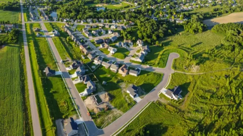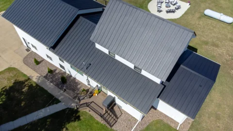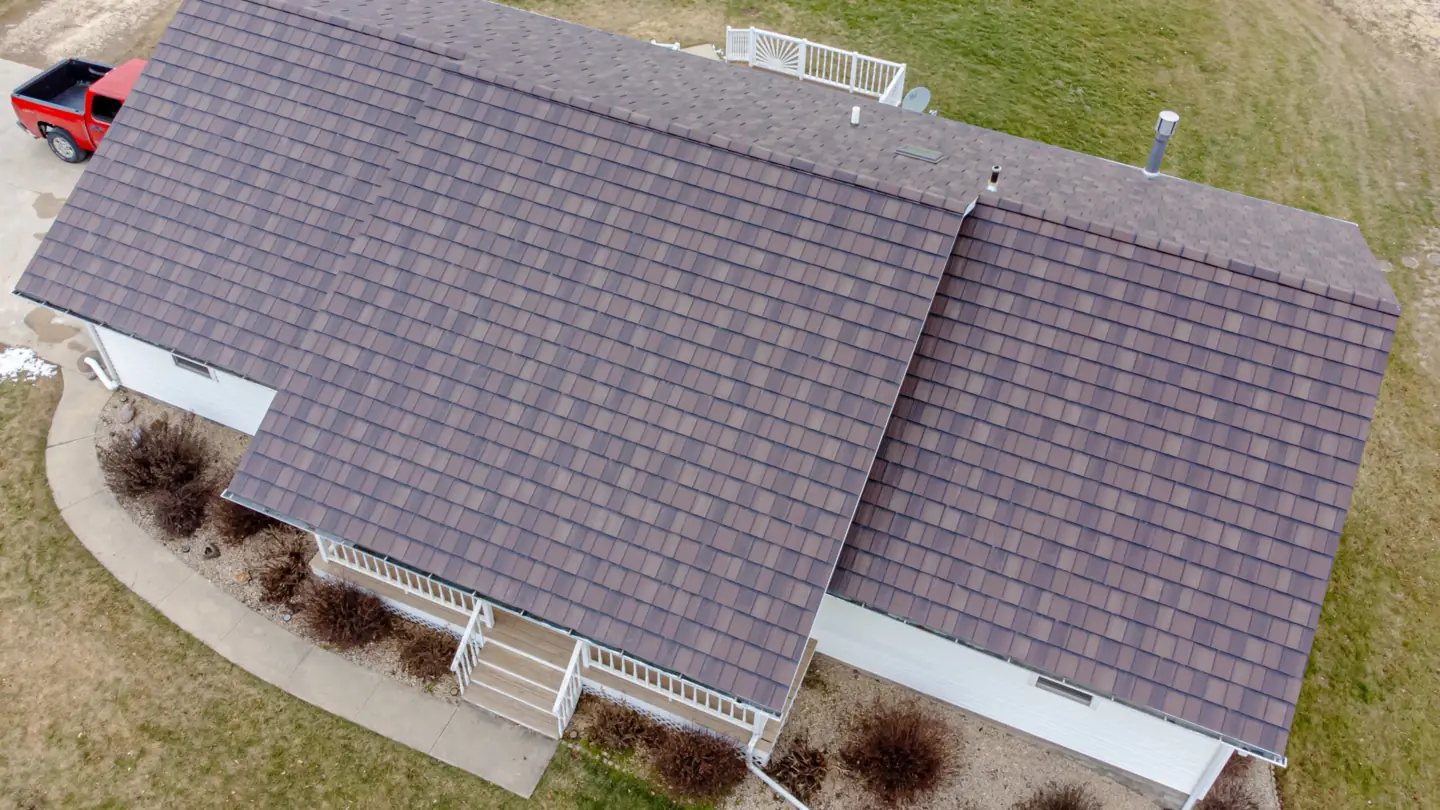
Drones have become a common way to photograph roofs. They reach steep, tall or fragile roofs without anyone climbing a ladder, and they produce a dated visual record in a single visit. They also have real limits, and knowing them up front saves time and disappointment.
Here’s a clear look at both, whether you’re a roofer, an adjuster, a property manager or a homeowner after a storm.
What a drone roof visit is, and isn’t
A drone roof visit is visual documentation: photos, and sometimes video, of a roof and exterior from angles that are hard or unsafe to reach any other way.
It isn’t a damage assessment, a repair estimate, an insurance decision or a licensed home inspection. Those are judgments made by roofers, adjusters and licensed inspectors, who can use the photos as evidence. At least one state regulator has addressed this directly: the Texas Real Estate Commission reminds licensed inspectors that its inspection standards still apply when they use a drone to look at a roof.
What drone photos can show clearly
With good conditions and careful flying, a drone photo set can document:
- the overall layout of the roof, its slopes and sections
- missing, lifted or displaced shingles, tiles or panels
- debris, fallen branches and tarps
- visible wear patterns, such as areas of granule loss
- flashing, vents, pipe boots, chimneys and skylights
- gutters and downspouts, including visible clogs and sagging
- staining or standing water on flat and low-slope roofs
- tree limbs overhanging the roof
Each photo records its capture date and time in the file (as long as the camera clock is set correctly), and a PDF photo report, if you order one, lists the capture date. That makes the set useful for before-and-after comparisons, maintenance records and conversations with contractors.
What drone photos can’t show
A camera sees surfaces. It can’t:
- see what’s under the surface, such as the underlayment, the decking or rot
- feel for soft spots, which takes someone on the roof or in the attic
- detect moisture trapped in the roof, or leaks inside the building
- show attic ventilation or interior conditions
- see under eaves and overhangs or into tight crevices
As the Texas Real Estate Commission reminds inspectors, some roof problems are only found by walking the roof.
Interpretation is another limit. Different kinds of wear and damage can look alike in a photo, and telling them apart takes an experienced roofer or adjuster, sometimes with hands-on testing. Good photos support that judgment; they don’t replace it.
Conditions that matter
Roof photos are more weather-sensitive than most aerial work:
- A dry roof with no snow or frost. Water and snow hide detail and create glare.
- Even light. Low sun and hard shadows can hide texture or exaggerate it.
- Manageable wind. The drone needs to hold a steady position near the roof.
- Room to fly. Power lines and trees close to the house can limit how close the drone can safely get.
Federal rules also still apply. Under the FAA’s Part 107 rules, the flight needs at least 3 statute miles of visibility, the drone must stay within the pilot’s line of sight, and flights in controlled airspace near many airports need FAA authorization first. Before every flight, the pilot must check the weather, the airspace and the hazards on the ground.
How a typical photo set is organized
A well-organized set follows a predictable order, so anyone reviewing it can find what they need:
- Overview shots of the whole roof from above.
- Elevations: the front, back and each side of the building.
- Each roof slope, photographed straight on.
- Close-ups of features such as vents, flashing, chimneys and skylights, plus any areas the roofer or adjuster asks for.
- A PDF photo report, when one is ordered, with labeled images, the property address and the capture date.
If your roofer or adjuster has a shot list, share it before the flight so the set matches what they need.
How roofers use drone photos
- Estimates and proposals. Seeing every slope before quoting helps plan the job.
- Customer conversations. Showing a homeowner a clear photo of the problem is easier than describing it.
- Before-and-after records. Dated photos document the finished work.
- Fewer climbs for overview photos. Hands-on inspection still happens where it’s needed, but nobody has to go up just to take pictures.
How adjusters, property managers and homeowners use them
- Adjusters use drone photos as documentation of a roof’s visible condition, often against their own shot list. The determinations remain theirs.
- Property managers and HOAs keep dated condition records across several buildings and track changes over time.
- Homeowners get a clear record after a storm to share with a roofer or insurer, and sellers get a dated record of the roof. Buyers need a licensed home inspector, who covers far more than the roof.
Thermal, measurements and 3D models
You may see these offered alongside roof photos. They’re different tools:
- Thermal cameras show temperature differences, not moisture itself. On some roofs, mainly low-slope roofs with insulation above the deck, infrared imaging is used to locate likely wet insulation. The standard practice for this (ASTM C1153) calls for suitable conditions (the surveys are typically done at night), qualified operators and follow-up testing to confirm what the images suggest.
- Measurements and 3D models are built by processing many overlapping photos. How accurate they are depends on ground control and processing, and without survey control a model’s position can be off by a few meters. In some states, selling maps or models that contain measurable data is regulated as land surveying.
If you need any of these, ask the provider exactly how the results are produced and how they should be used. At Drew’s Drone Services, they’re “ask us” items: tell us what you need, and we’ll tell you whether we can help or who can.
When you still need someone on the roof
If the photos show something worth a closer look, or you suspect a leak, call a licensed roofer. For an insurance claim, your insurer’s adjuster makes the determination. If you’re buying a home, a licensed home inspector covers far more than the roof.
Drone photos give all of them better information to work with. They don’t replace any of them.
This article is general information, not professional roofing, insurance or legal advice.
Need roof photos? See our roof and exterior photos service, or request a quote and include any shot list you need us to follow.
Sources
- 14 CFR Part 107, Small Unmanned Aircraft Systems (eCFR)
- FAA, Part 107 Airspace Authorizations
- FAA Advisory Circular 107-2A, Small Unmanned Aircraft Systems (weather and preflight guidance)
- Texas Real Estate Commission, “Using a Drone to Inspect the Roof? Keep This In Mind” (2025)
- ASTM C1153, Standard Practice for Location of Wet Insulation in Roofing Systems Using Infrared Imaging
- Pix4D, accuracy of aerial mapping projects (absolute accuracy without ground control is in the range of a few meters)
- 360 Virtual Drone Services LLC v. Ritter, 102 F.4th 263 (4th Cir. 2024)